MAHG 41 Appalachian Trail Challenge
September 29, 2018
Sections
The hike starts at Pen Mar Park, in Cascade, MD, and ends in Harpers Ferry, WV. The hike is broken into the following sections:
1.
From Pen Mar Park to Wolfsville Rd (~10 mi).
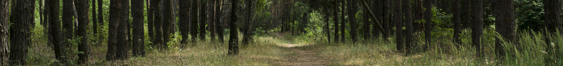
This hike section begins near the Mason-Dixon Line, the border between Pennsylvania and Maryland. Highlights of this section include Pen Mar Park, a former

amusement park built in the late 1800s; High Rock for its scenic vistas and the highest point on the AT in Maryland; the boulder-strewn section called the Devils Racecourse (reached via a side trail off the main AT); and Ravens Rock. This section of the hike ends at Wolfsville Road (MD 17). This hike includes one of the more challenging ascents, a 440-foot climb over 0.5 miles, to the top of Quirauk Mountain; scenic High Rock makes a good place to stop for a brief rest.
2.
From Wolfsville Rd to I-70 (~9 mi).
A gently undulating ridge trail runs through a chestnut oak forest on South Mountain, leading to a pair of views from Black Rock Cliffs and Annapolis Rocks. On a clear day, four states are visible from these overlooks: Maryland,

Pennsylvania, West Virginia, and Virginia. Both of these spectacular crags include rock slabs, overhanging cliffs, small caves, tumbled boulders, and views that look west across a side farm valley toward Hagerstown. The jagged, exposed quartzite ledges at Annapolis Rock and Black Rock create much of the erosion-hesitant bedrock of South Mountain. This portion of the AT in Maryland is one of the most scenic.
3.
From I-70 to Civil War Correspondents Memorial (~12 mi).
This section of the hike passes through three mountain gaps where some of the fiercest fighting of the Civil War occurred just 3 days before the two sides met again to the west at Antietam on September 17, 1862, in the bloodiest

single day of fighting of the Civil War. The trail also passes near the original Washington Monument, a stone tower with steps leading to a great view and fantastic photo opportunities, before continuing along the ridge of South Mountain with a moderate ascent of Lambs Knoll (800 feet over 2.5 miles), leading to White Rocks, a quartzite cliff facing south. At the end of this section, Gathland State Park encompasses Crampton Gap, one of the battle sites on South Mountain. This park features an unusual monument, the Civil War Correspondents Memorial, built by a famous Civil War journalist, George A. Townsend, in 1896.
4.
From Civil War Correspondents Memorial to Harpers Ferry (~10 mi).
The final section of the Appalachian Trail across Maryland departs from Gathland State Park along a wide forest path. The trail is mostly flat for the first 5.5 miles or so, running

along the ridge of South Mountain until reaching the Weverton Cliffs at the southern end of the mountain. The cliffs are reached by following a short (01. mile) side trail, and the view from this vantage point, taking in the almost sheer drop to the Potomac River below and the gap where Harpers Ferry sits to the west, makes the detour well worth it. Back on the AT, the trail descends down to the river valley using a series of 16 switchbacks, then joins the C&O Canal Towpath to reach the Goodlow Byron Memorial Footbridge. Crossing the footbridge over the Potomac River into Harpers Ferry, WV, brings the MAHG 41 Appalachian Trail Challenge to its end.